Geography in the News: January 2025 Edition

Last updated: Jan 14th, 2025


Geography in the News: January 2025 Edition

Many news articles address geographical issues, however, students don’t always make the link between current events and the geography they are studying in school. Below is a selection of recent news events, demonstrating how geography is represented in the news. The accompanying links allow students to delve further into the story, to enable further independent research, or to form the basis of collaborative learning.

Valencia flash flooding: a natural disaster?

Flash flooding damaged the city of Valencia and the surrounding area, leading to hundreds of deaths and destroyed infrastructure. Did poor management contribute to this disaster?

Read more

Antarctica is going green

Researchers have mapped the growth of algal blooms in Antarctica. Is this spread due to rising temperatures and could this help to mitigate against climate change?

Read more

Indonesia’s Mount Lewotobi Laki-laki bursts into life

The latest eruption of Indonesia’s Mount Lewotobi Laki-laki triggered multiple volcanic hazards. What were the effects and how did the authorities respond to this volcanic event?

Read more

Remote Mayotte islands hit by powerful cyclone

Cyclone Chido struck the Mayotte islands, leading to dozens of casualties, destroyed infrastructure, and ruined crops. Was French President Macron’s response to this tragedy problematic?

Read more


Valencia flash flooding: a natural disaster?

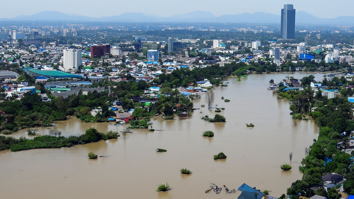
On 29 October 2024, a small low-pressure area dumped a year’s worth of rain in just 8-hours in the mountains of Eastern Spain. Water flowed rapidly down the steep mountain slopes before cascading through narrow river valleys towards the city of Valencia at the coast (Figure 1).


Figure 1: The extent of flash flooding in Eastern Spain (October 2024)

What were the effects of the flood?

Many houses were damaged or inundated by the muddy floodwaters. The floods destroyed bridges and damaged infrastructure, such as electricity supplies. The city of Valencia was particularly badly affected.

  • More than 220 people were killed in what was Spain’s deadliest flood in modern history.
  • The Bank of Spain estimated that the costs of the flooding exceeded US$21 billion (US$14 billion for homes, and US$7 billion for businesses).
Did poor management contribute to the disaster?

Whilst this was undoubtedly an extreme weather event, the impacts may have been made worse by poor management.

  • Despite advance warnings of an extreme rainfall event from the State Meteorological Service (AEMET) highlighting the potential for serious flooding, warnings were not relayed to the public (via mobile phones) until it was too late.
  • Eye-witness reports suggested that less than 10 minutes after receiving warnings, streets were already submerged.
  • Valencia’s regional leader faced criticism for taking 12-hours to respond to a red warning from AEMET.
  • Many people tried to escape the floods in their cars. Swept away by the floodwaters, most cars ended up piled on top of one another at the end of every street (Figure 2). Many people drowned in their cars.
  • There was criticism about the slow response of emergency services and the apparent lack of preparedness for such an event.
  • Conflicts arose between local and national government, the hydrological and meteorological agencies and the armed services regarding levels of preparedness, responsibility and inadequate response coordination.

Figure 2: Many people died in their cars as they tried in vain to escape the flooding

Should Valencia’s regional president resign?

The regional president of Valencia, Carlos Mazón, faced calls to resign over his handling of the disaster. Addressing the regional parliament in November, he proposed establishing a parliamentary commission to investigate the tragedy. He said that the whole system had failed and that the central government was largely to blame for failing to coordinate between institutions. Despite admitting personal errors, Mr Mazón is still in post.


 Back to the top


Antarctica is going green

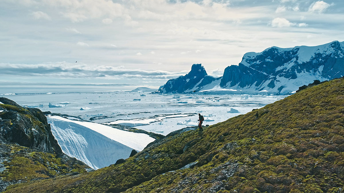
A recent report by Cambridge University has highlighted the rapid spread of green algae on the surface of snow along the Antarctic Peninsular coast. A team of researchers from Cambridge University and the British Antarctic Survey used satellite data and ground research to construct the first ever large-scale map of microscopic algal blooms (known as ‘green snow’) in Antarctica.


Algae growth and climate change

The spread of algae is a response to rising temperatures. It is typically found in the warmer parts of the continent where the average temperature is just above zero in the summer months. Whilst this may seem to be a negative consequence of climate change, algae capture carbon dioxide from the atmosphere through the process of photosynthesis.

This is an example of a negative feedback. As the climate warms and algae spreads, more carbon dioxide is absorbed from the atmosphere. This slows the rate of warming and helps to mitigate climate change.

Scientists predict that the overall mass of algae will increase in the future as temperatures continue to rise. Whilst some algae will be lost as snow melts on the lower ground, this will be outweighed by blooms spreading inland onto higher land.


Indonesia’s Mount Lewotobi Laki-laki bursts into life

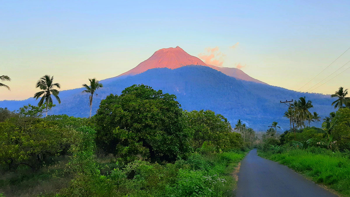
In early November 2024, Mount Lewotobi Laki-laki on the Indonesian island of Flores erupted multiple times sending columns of ash up to 8,000m (5 miles) into the air.

Mount Lewotobi Laki-laki is one of two volcanoes at the eastern end of the island. It has been erupting sporadically since December 2023. Volcanologists monitoring the volcano had issued an official warning before the latest eruptions, advising people to stay at least 3km away.


What were the effects and responses of the eruptions?

The eruptions have triggered multiple hazards including ashfalls, volcanic bombs, pyroclastic flows, lahars and flash floods.

  • At least 10 people have been killed by the eruptions
  • Volcanic bombs rained down on nearby villages burning and damaging houses
  • The authorities imposed a 7km exclusion zone around the volcano
  • Over 10,000 people evacuated from the area have been housed in temporary accommodation

Traditionally, many people have chosen to live close to the volcano to farm the fertile soils. However, the prolonged period of volcanic activity has impacted the local economy, as thick deposits of ash has smothered local cashew nut farms, ruining crops.


 Back to the top


Remote Mayotte islands hit by powerful cyclone

In December 2024, the remote Mayotte islands, a French territory located in the Indian Ocean between Madagascar and Mozambique, were struck by Cyclone Chido. The tropical storm – the most powerful to strike the islands for 90 years – killed dozens of people, destroyed vital infrastructure and flattened houses and crops (Figure 5).

In the aftermath of the storm, the French president, Emmanuel Macron, was criticised for the slow pace of relief and for the high levels of poverty, such as water shortages and poor-quality housing. Of Mayotte’s 320,000 people, up to 200,000 people are thought to live in tin-roofed shacks, which are highly vulnerable to damage from strong winds.


Find out more:

BBC News

Lemonde.fr

 Back to the top

Simon Ross

Meet the Author


Simon Ross is a former Head of Geography and prolific author of geographical teaching resources.

He has written extensively for the new GCSE and A-level specifications. He acts as a geography consultant for a variety of organisations, and has written and presented educational videos from locations around the world, including Iceland and Italy. He also delivers CPD training for teachers and students. In his spare time he enjoys running, gardening and tending his allotment!